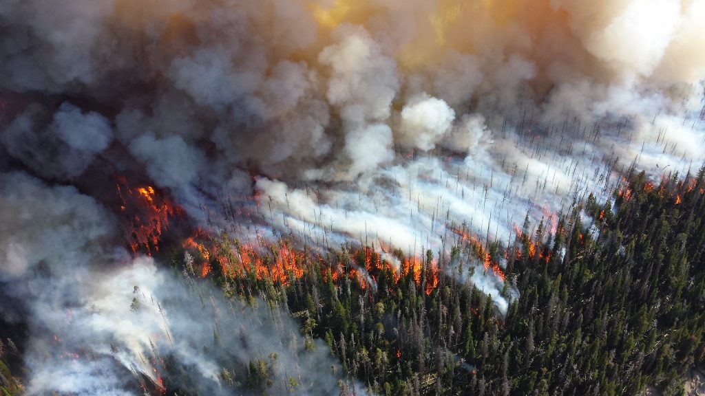
Bozeman, Mont.—A new interactive map released today exposes an alarming reality: Western forests are burning far faster than they’re being treated for fire prevention, leaving millions of acres at risk of catastrophic blazes.
The groundbreaking analysis, produced by researchers at the Property and Environment Research Center (PERC) and the University of California, Davis, reveals that while nearly 13 percent of U.S. Forest Service land in the West burned over the past decade, less than 4 percent received preventive treatments like prescribed burns and thinning.
California emerges as particularly vulnerable. The map shows that 23 percent of Forest Service land in the state has burned since 2013, yet only 3 percent has received fire-prevention treatment. Of the 10 congressional districts facing the highest wildfire risk, nine are in California—but half of these high-risk districts have treated less than 1 percent of their forest land.
“This map is a necessary tool to show where we’re falling behind in protecting our forests,” said Hannah Downey, policy director at PERC. “It reveals not just where fires have burned, but where they’re most likely to burn next and some of the obstacles to wildfire prevention—giving policymakers a blueprint for dramatically accelerating forest restoration efforts.”
The stakes are enormous. The Congressional Joint Economic Committee estimates wildfires cost between $394 billion and $893 billion annually—as much as 4 percent of U.S. GDP—through property damage, health impacts from smoke, water contamination, and lost ecosystem services. The interactive tool breaks down wildfire risk and treatment data by congressional district, allowing policymakers to see exactly how their constituents are affected.
“With wildfires becoming more frequent and severe, it is critical that policymakers have clear, accessible data to guide decisions,” said Sara Sutherland, PERC senior research fellow and lecturer at U.C. Davis. “This new map equips decision-makers with critical data to help direct resources where they are needed most.”The map comes as western states face increasingly severe fire seasons, with over 64,000 acres already burned in 2025. It provides unprecedented district-level detail about areas at risk, acres already burned, and lands treated with restoration practices—critical data for prioritizing forest management efforts. Previous PERC research reveals the extent to which forest restoration efforts are delayed by federal environmental reviews, with it taking 4.7 to 7.2 years on average to begin a prescribed burn once the Forest Service initiates the review process. These delays further exacerbate the wildfire threats facing America’s western forests.